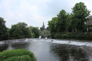
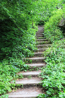
I suppose due of the transfer of power and ownership over the centuries, the castle took on a medley of structural ideas. We opted out of the tour, but I did hear the guide mention that it was the ladies of the house that always wanted improvements made. 😉
"Come away, O human child: To the waters and the wild with a fairy, hand in hand, For the world's more full of weeping than you can understand." William Butler Yeats
Sunday, June 17, 2018
Cahir Castle
Friday, June 15, 2018
Mizen Head
Mizen Head Signal Station is located at the end of the Kilmore Peninsula the utmost south-western point of Ireland. This is one of the most dramatic, stunning & breathtaking places I have seen in Ireland and the weather the day we visited could not have been more perfect.
This is the sort of place you have to be ‘in the area’ to visit. It’s not the sort of place you can decide on a whim to explore. After driving Ireland for the past year, I’ve discovered anytime you drive out to the end of one of the peninsula’s you must plan for 4-5 hours round-trip driving time. The roads tend to get smaller and narrower the further out you go. So, after a few hours of winding roads, some looking more like someone’s driveway than a public road, I was astonished to find the parking lot full of cars and even some smaller motor homes. Obviously more crazy folks like us that want to discover the best of what Ireland has to offer.
They have a small gift store, cafe and educations/history area to walk through before you buy your ticket and head out to the cliffs.
The cliffs here rise high above the Atlantic Ocean and are glorious. They say they are so dramatic because it’s where the currents meet up from the west & south coasts, the storms pound the land and years of shifting helped in the formation as well.
The lighthouse is now automated as most are, but for years the lighthouse keepers lived and worked on the peninsula, under all conditions of weather. Mizen head barely touches the mainland and various bridges have been constructed over the years for keeper access.
Fortunately for us the ‘new’ bridge (reconstructed replica in its original design from the early 1900’s) opened to the public in 2009. Along with the bridge, they have created numerous viewing platforms all along the cliffs for your viewing (and picture taking) pleasure. Their home page states “Enjoy the exhilaration of the walk down the cliffs!” Ugh.
Even though the bridge spans high above the gorge, about 150 feet, you still have to walk down to get to it and it’s a fairly steep slope too. Oh, but so well worth the hike. From each platform you are treated with another spectacular view of the surrounding cliffs.
Once across the bridge we hiked up to yet another platform and could see from Dunlough bay to Sheep’s head to the Beara Peninsula, maybe even Dursey Island way off in the distance. Breath taking. Coming back up we opted to take the famous 99 steps – which is one way (UP). We stopped at the café for tea/coffee & a few more pictures.
This is definitely lands end, Irish style.
PHOTO ALBUM
This is the sort of place you have to be ‘in the area’ to visit. It’s not the sort of place you can decide on a whim to explore. After driving Ireland for the past year, I’ve discovered anytime you drive out to the end of one of the peninsula’s you must plan for 4-5 hours round-trip driving time. The roads tend to get smaller and narrower the further out you go. So, after a few hours of winding roads, some looking more like someone’s driveway than a public road, I was astonished to find the parking lot full of cars and even some smaller motor homes. Obviously more crazy folks like us that want to discover the best of what Ireland has to offer.
They have a small gift store, cafe and educations/history area to walk through before you buy your ticket and head out to the cliffs.
The lighthouse is now automated as most are, but for years the lighthouse keepers lived and worked on the peninsula, under all conditions of weather. Mizen head barely touches the mainland and various bridges have been constructed over the years for keeper access.
Fortunately for us the ‘new’ bridge (reconstructed replica in its original design from the early 1900’s) opened to the public in 2009. Along with the bridge, they have created numerous viewing platforms all along the cliffs for your viewing (and picture taking) pleasure. Their home page states “Enjoy the exhilaration of the walk down the cliffs!” Ugh.
Even though the bridge spans high above the gorge, about 150 feet, you still have to walk down to get to it and it’s a fairly steep slope too. Oh, but so well worth the hike. From each platform you are treated with another spectacular view of the surrounding cliffs.
This is definitely lands end, Irish style.
PHOTO ALBUM
Thursday, June 14, 2018
Blarney Castle - revisited
This time however the four of us walked the various magnificent gardens of the Blarney Castle grounds. The gardeners and caretakers of Blarney have outdone themselves with such a collection of plants and walking areas. I had no idea last time we were here of the assortment of flora presented for viewing and picture taking pleasure.
There is the Fern garden, the Herbaceous border, the Bog, Himalayan Walk, the Jungle, the Poison Garden and the Woodlands River and Lake walk. Not every plant is marked so most time we did not have a clue what it was we were ‘loving’.
PHOTO ALBUM
Sunday, June 10, 2018
Fore Priory & Drogheda
After our workout at the Gobbins we drove to Drogheda for the night. The town of Drogheda, just north of Dublin is one of the oldest in Ireland. It's also a great starting point for a tour of the Boyne Valley with all its history.
The hotel we stayed in was nice enough, old, in a rather questionable part of town. (I've never seen the interior of a hotel done in yellow & black) we thoroughly enjoyed dinner and a few whisky & ginger-ales.
Millmount Fort is the most dominant structure in the city. Sitting high above the city is all that's left of the fortification of the once walled city. It does offer some impressive views of the city and Boyne river. Our guide was extremely informative on the history of the town - he's lived there all his life and does not drive a car (which I found more interesting than the history) The old fortifications were basically demolished in the early 1800's and this new fort rebuilt. It was again extensively damaged during a civil war in 1922 - but restored by the Drogheda Corp. and has been open to the public since 2000. The two cannons are fired on special occasions.
We explored the Fore Priory last July but were so impressed we wanted to return with Joe & Charlotte. These ruins are not spoiled by tourism. We stopped at the same little cafe for Tea & Coffee (elevenses) and found Bibi, the student from Athlone Institute of Technology was still working there for her Mom on weekends.

PHOTO ALBUM - Drogheda
PHOTO ALBUM - Fore Priory
The hotel we stayed in was nice enough, old, in a rather questionable part of town. (I've never seen the interior of a hotel done in yellow & black) we thoroughly enjoyed dinner and a few whisky & ginger-ales.
Millmount Fort is the most dominant structure in the city. Sitting high above the city is all that's left of the fortification of the once walled city. It does offer some impressive views of the city and Boyne river. Our guide was extremely informative on the history of the town - he's lived there all his life and does not drive a car (which I found more interesting than the history) The old fortifications were basically demolished in the early 1800's and this new fort rebuilt. It was again extensively damaged during a civil war in 1922 - but restored by the Drogheda Corp. and has been open to the public since 2000. The two cannons are fired on special occasions.
PHOTO ALBUM - Drogheda
PHOTO ALBUM - Fore Priory
Saturday, June 9, 2018
The Gobbins
The original Gobbins Path opened in 1902, but was abandoned in the 1960’s. Then in 2015, an investment of over £7.5 million brought the path back to life as the spectacular tourist attraction it is today with many improvements.
We gathered at the visitor center at our appointed time. After a brief safety talk, physical warnings that this ‘walk’ may not be suitable for everyone were bused to the location where we would start our adventure. Once there, the access road that would take us to the start of the walk was one we had to walk down – a very steep long road. My knee was not happy with this! Come to learn, the walk would not be a loop, but one way in and one way out, and damn, back up that same steep long road. The cliff walk itself was enough of a challenge for this old girl – the access road was homicidal.
PHOTO ALBUM
Bushmills
This would be our 4th and final visit to the wonderful location of Bushmills in Northern Ireland. Always seems strange that it's not the Republic of Ireland, but part of Great Britain. We have to inform the rental car company each time we intend to go 'out of the country'. The road speeds change from kilometers to miles-per-hour, British flags fly and euros are no longer accepted. There are no Garda, but Police. The border between the two countries is considered 'soft' and Great Britain is trying to change that but Northern Ireland does not want a hard border. So it's easy to come and go between the two right now. Since we've been here before and blogged about it I've keep my dialog short. As always a great place to visit and bring along friends. Be sure to check out the pictures, they are new 😉
At the Bushmill Distillery we saw how whiskey was made and sampled a wee bit of it (yummy) mixed with various fruit juices. My new favorite is whiskey and ginger-ale.
We revisited Dunluce Castle, as well as Giants Causeway. Dunluce is by far my most favorite castle ruins. Last time here (in March with my sister Pat) I got a fabulous shot of a rainbow, but there was not a chance of that on this day since the sun shone bright and clear.
Giants Causeway was the most crowded I have ever seen it. Solid tourists (yuck). So rather than hang out with a few hundred of our closest friends, we hiked the mountains and got some spectacular shots of the coastline.
In the evening we hiked back up another mountain and watched the sunset.
Causeway Hotel with a full moon |
Stone Fort of Grianan
Our friends, Joe & Charlotte, arrived from the states for a 2-week holiday with us. What a great excuse to plan more touring adventures of Ireland.
After a wonderfully enlightening tour and shopping spree at Belleek Pottery we headed to our first stop - An Grianan Hotel in Inishowen. Since the night was still young we decided to hike up a small hill to see what sort of view it may offer up. We met Marie along the way who invited us into her yard for a clear view of the valley and sea below. Apparently, she and her husband bought the land and built the house. She tells us she has been blessed with that view for 50 years. She was a delight, one of those rare treasures of Ireland.
The next morning, we continued up on that same road (via car this time) to the Stone Fort of Grianán of Aileach which sits about 800 feet above sea level. Here's the history lesson - “The origins of the Grianán of Aileach fort are dated back to 1700 BC. It is linked to the Tuatha de Danann who invaded Ireland before the Celts and built stone forts on top of strategic hills. They worshipped Dagda (the Good God) and he too is associated with the origins of Aileach. It was he who ordered the building of a stone fort to act as a burial monument to his dead son.”
It is thought that St Patrick actually visited the site in the 5th century and baptized the local chieftain, Eoghan there.
The fort which was mostly constructed without mortar of any kind was restored to its present state in the 1870’s. There are very narrow, and challenging, stone steps to each of the three levels within the interior.
Once on the top level the panoramas were breathtaking in any direction. We were very fortunate to have a warm and sunny day.
PHOTO ALBUM
Marie |
Her View |
The next morning, we continued up on that same road (via car this time) to the Stone Fort of Grianán of Aileach which sits about 800 feet above sea level. Here's the history lesson - “The origins of the Grianán of Aileach fort are dated back to 1700 BC. It is linked to the Tuatha de Danann who invaded Ireland before the Celts and built stone forts on top of strategic hills. They worshipped Dagda (the Good God) and he too is associated with the origins of Aileach. It was he who ordered the building of a stone fort to act as a burial monument to his dead son.”
Joe & Charlotte |
It is thought that St Patrick actually visited the site in the 5th century and baptized the local chieftain, Eoghan there.
The fort which was mostly constructed without mortar of any kind was restored to its present state in the 1870’s. There are very narrow, and challenging, stone steps to each of the three levels within the interior.
PHOTO ALBUM
Subscribe to:
Posts (Atom)